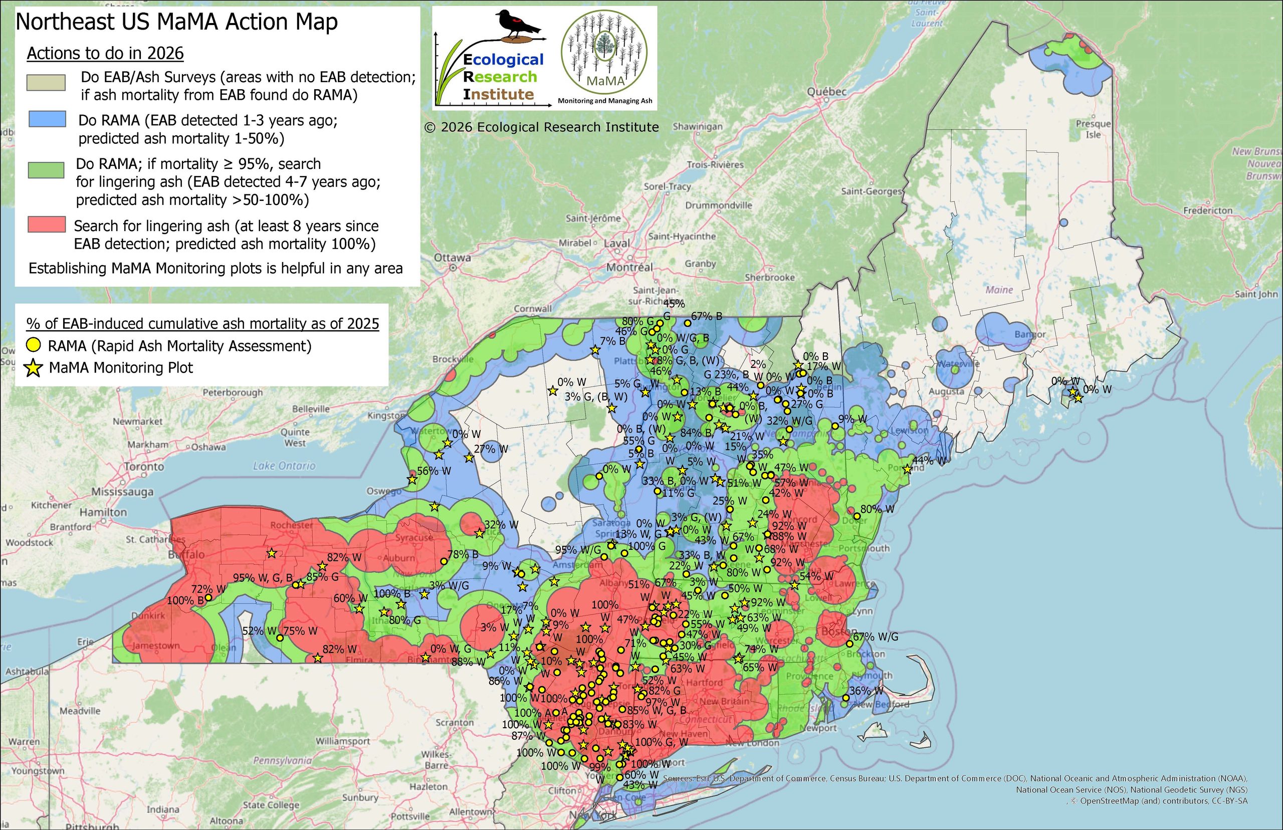

MaMA’s annually updated action maps show: 1) areas known or projected to be ready to search for lingering ash; and 2) areas needing more data and which MaMA project to use to collect it. The maps are initially created using EAB detection data to project when and where 95% mortality will be reached, but they are then refined and updated using data collected by MaMA projects.
Northeastern US MaMA action map – overview
Click the link above to open our current Northeastern U.S. action map in CalTopo. You can see your location in the MaMA action map on CalTopo by clicking the target symbol in the right bottom corner. The yellow starts show MaMA monitoring plots and yellow points MaMA RAMA (Rapid Mortality Assessment) observations. The numbers associated with each point represent the mortality at that site as of the last field season.